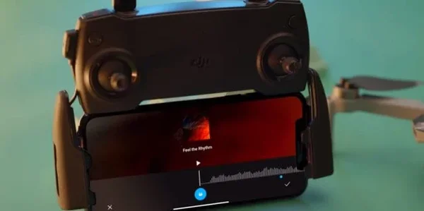
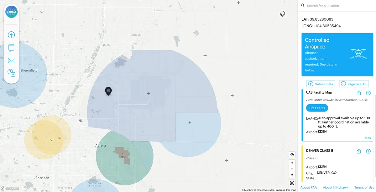
The DJI Fly app comes pre-paired with every consumer DJI drone, and for most pilots it's the only app they ever touch. That's fine, DJI Fly does the job. But it also makes deliberate tradeoffs: no waypoint missions on consumer drones, no advanced telemetry logging, no automated flight paths, no pre-flight airspace checks. DJI left those features out of the box on purpose.
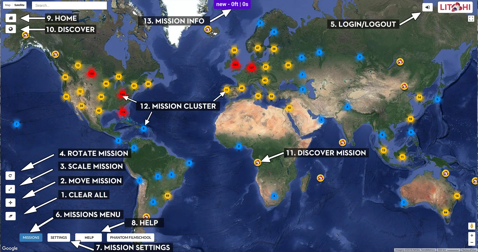
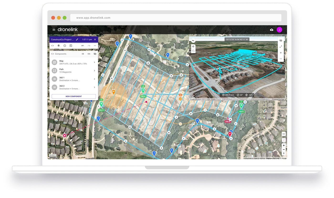
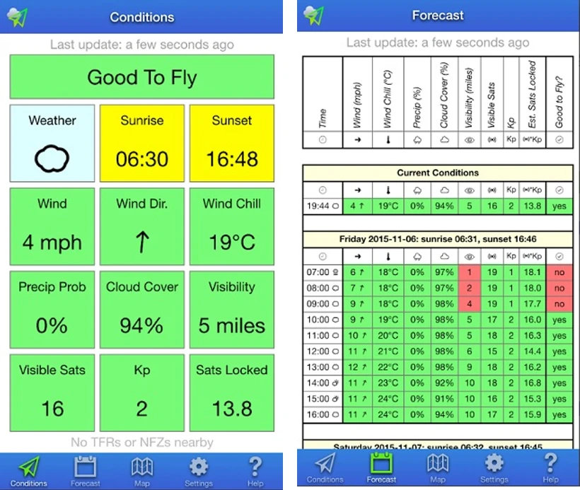
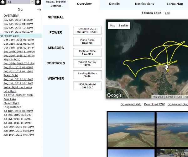
Third-party apps fill those gaps. Litchi adds waypoint missions and Follow Me to drones that don't have them natively. Dronelink turns your flight plan into a fully automated sequence you can replay anywhere. UAV Forecast tells you whether the wind will actually cooperate before you drive 45 minutes to a location. AirData logs every flight automatically and builds the paper trail you need for Part 107 work.
This list covers the seven apps worth installing if you fly a DJI drone seriously, DJI's own apps where they're genuinely useful, and third-party alternatives where they outperform the official options. We also cover what changed in 2026 with the U.S. regulatory environment around DJI software and what it means practically for pilots who depend on app integrations.