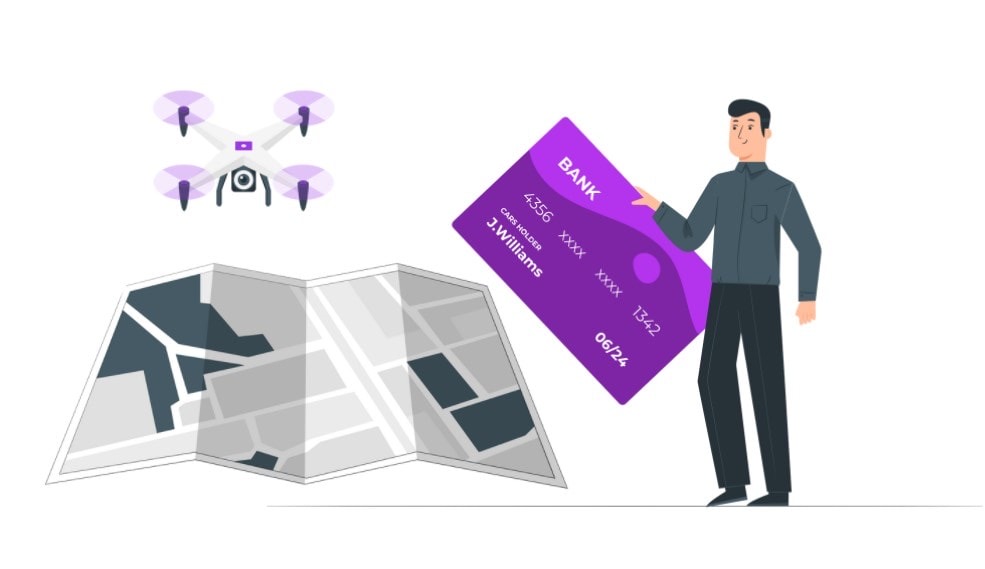
Dronesgator logo

How Much Does a Drone Land Survey Cost? (Updated 2023 Prices)

Updated in 2023 by Paul Posea
price of drone mapping cost

You may have a plot of land that you’d like to survey and you’re wondering if having it done with a drone instead of a traditional surveyor (or team of surveyors) might be a better option. 

The short answer is yes, drone surveys are better than their traditional counterparts. But that begs the question; How much does a drone land survey cost?

In most cases, the national average drone land survey can cost between $30 and $120 per acre. It can be even higher or lower than that depending on the type of survey and the amount of time needed to complete the work.

In this article, I’ll go in-depth on why I think drone land surveys are better (and cheaper) than manual ones. We’ll also look at some of the factors that determine the cost of drone surveys.

How Does a Drone Survey Work?

Surveying in general, whether done by drones or humans, is the science of determining the distance and positions between two points.

This information collected is then used to help make critical decisions about the land. It’s useful for land developers, construction companies and even the average person trying to sell their plots of land.

A drone land survey is done with those same principles, but instead of using a team of 5 land surveyors only one inspector is enough to operate the drone (cutting costs in the process).

As the drone flies above the ground, it uses downward multispectral and RGB cameras to capture images. Those images are then compiled through software and organized by the inspector, who can then look at the data and make a report.

It’s a complicated field, deserving of an article of its own. But below is a good video that I think will at least give you an idea on the overall process of drone land surveying.

Drone Surveying for Beginners

The Cost of Drone Land Surveys per Hour

We’ve seen that the general costs of drone surveys range between $30 and $120 per acre, but as I said, we’ll have to expand on that.

And what better way than to look at the cost per hour, rather than by the acre. The average hourly cost of a drone survey is $26 / hour.

To go even further than that, we have this table from Ziprecruiter on how much drone land surveyors charge for their service:

PercentileHourly cost
Top 10%$45
75th Percentile$30
Average$26
25th Percentile$16

Keep in mind that the average $26 hourly cost is made on a national level so in certain states you might find it higher. Below are 10 US cities with the highest drone survey costs:

CityAverage Hourly Cost
Sunnyvale, CA$32.52
Santa Rosa, CA$31.43
Cambridge, MA$30.48
Vacaville, CA$29.89
New York City, NY$29.56
Fairfield, CA$29.53
San Mateo, CA$29.36
Lynn, MA$29.11
Anchorage, AK$29.06
Baltimore, MD$28.62

The Cost of Drone Surveys vs Manual Surveys

We’ve gone over a lot of information regarding the cost of drone land surveys. And while that’s great and all, you might be wondering why you should consider doing your land survey with a drone rather than traditionally.

For one thing, the price of drone surveys is way lower than traditional methods. In this section I’ll do a full breakdown of traditional survey costs.

According to HomeAdvisor, hiring a professional land surveyor will cost you around $517 which is the national average. Pricing however can range from $200 on the low end, to $1000 on the high-end.

Land survey cost per Acre

Land Survey Cost per Acre

Usually, land surveys can cost between $50 and $500 per acre. depending directly on the land size, how filled with trees it is and how many property corners you need marked. 

The larger your estate and the more markings you need, the more you can expect to pay. However, with an increase in acreage, the rate per acre decreases. 

Rates also differ among professionals and regions, so there’s no hard-set, per-acre rate. However, for large parcels - those 5 acres or larger - most pros charge per square foot, which could run anywhere from $0.15 to $0.70 or more, or per hour.

Below is a table breaking down the price per acreage for traditional land surveys: 

AcreageAverage Reported Cost
1/5 (average U.S. lawn size)$400 - $700
Up to 2$500 - $1,000
Up to 10$500 - $1,500
Up to 20$1,000 - $2,000
Up to 40$2,000 - $5,000
Up to 80$2,000 - $6,000
100 to 200$3,000 - $10,000
200 to 350$5,000 - $20,000

Lastly, to give you a better (and more realistic) idea, here is an average survey cost for several states:

  • New York: $380–$900
  • South Carolina: $250–$600
  • Texas: $200–$550
  • Oregon: $375–$1,500
  • Illinois: $350–$700

Conclusion

You can clearly see that drone land surveys costs are far below those of traditional surveys. 

A drone land survey costs an average of $100 while a traditional one costs on average $517!

The Cost Factors of Drone Land Surveys

When it comes to land surveying, no job is ever the same. And that means the cost is ever-changing, depending on the project. I’ve attempted to compile a list of some factors that have a big influence on the costs.

The Size of Your Land

When it comes to drone land surveying, size matters. Obviously, seeing you’ll be looking at a price per acre, size will be the biggest factor.

But it’s more complicated than that. Pricing here isn’t linear, in fact, it’s hardly a reliable curve to predict costs with.

Most drone surveyors will charge you less per acre after you cross a certain acreage threshold. Or more, it depends on the service provider.

Usually, larger sized projects/lands see economies of scale, with operations in the field being lengthier. This is a good thing, meaning the drone surveyor can give you scale pricing (lower cost for you).

The Scope of Work

A drone land survey heavily depends on scope of work. An engineer looking for a clean point cloud to use in CAD for design purposes requires a less intense scope of work compared to a developer looking to develop 100 acres. 

The land developers scope of work will include contour maps, elevation grids, volumes, and other outputs. In other words, the developer requires an in depth scope of work, whereas the engineer is looking for one deliverable. 

The developers scope of work adds significant time and cost due to the amount of work that has to be done by a skilled CAD technician. 

So definitely keep that in mind, and do your research regarding your land if accurately estimating a price is crucial.

Tolerances

Since we’re on the subject of scope of work, tolerances need to be mentioned. Tolerance in land surveying lingo is the maximum acceptable amount of Positional Uncertainty for any physical point on your property.

The standard tolerance rate is 0.1 ft. If that’s what you’re looking for, you can expect standard pricing. If however you’re looking for “tighter” tolerances (0.05 ft for example), then you should expect an increased cost. 

That’s because the tighter the tolerance the more time is spent in the field and later in the office to ensure the quality of the data.

Other Cost Factors

Size and scope of work are the two most important cost factors when it comes to land surveying. There are however other factors:

Research & Travel Time

Part of the surveyor's job is to research the property's deeds and other official records to compare with physical markers like fences and walls. 

If it has already been well documented, it will save time on the process, which ultimately saves money. Likewise, the farther the professional needs to travel to get to the location, the more you will pay. (some surveyors will only surcharge you the travel fees after a certain mileage)

Required Land Survey Documentation

Your land may require specific land survey documentation in the event of a sale. This largely depends on the title company, and the land surveyor must comply with their requests. 

Gathering and completing all documentation may increase the time it takes the surveyor to wrap up their survey. Which will naturally increase the cost of your survey.

Documentation is often overlooked when calculating land survey cost factors. 

Technologies Used for Drone Land Surveys

I won’t go too in-depth in this section, as this is a very complicated subject and needs several articles of its own.

But it doesn’t hurt to understand the process and technology drone land surveyors use. It’ll at least make you “speak their language”, so to speak.

As we’ve discussed above in the “How drone surveys work” section, drones use downward multispectral and RGB cameras to capture images which are run through software to give a clear “stitched” map of sorts (individual images stitched together).

The most notable tech used for drone surveys is LiDAR, which can help a drone to see through trees and ground cover. This process uses lasers to fire at a specific target to see in complete darkness or with obstacles in the way.

I hope this small crash course on drone technology didn’t leave you too confused.

Drone Surveying vs. Manual Surveying

We’ve seen how drone surveys compare to their traditional counterparts, but that was a price-only comparison. In this section we’ll go over why drone surveys are far more efficient than traditional ones (it’s not just the pricing).

Drones excel at providing vantage points that are simply not accessible to human beings. At least not easily.

While traditional surveying methods require meticulous measurement, preparation, and planning, drones can capture comparable data in dramatically shorter timeframes.

For example, STRABAG, an Austrian construction company estimates drones enable them to conduct surveys with 75% reduced set-up time.

Drones Provide More Data

Drones produce 100,000 times more data in much less time. The massive amount of data allows for the creation of highly accurate and detailed 3D models of land. Below is a table of comparison between drone surveys and traditional surveys:

ComparisonTraditional land surveyDrone land survey

Field Data Collection
24.0 hours2.5 hours
Office Technician Time16.0 hours8.0 hours
Professional Surveyor1.0 hours1.0 hours
Total Number of Data Points2,500250,000,000

Drones Capture the Entire Survey Site

Another advantage of drone mapping is the fact that there is hardly ever a need to go back to the site to collect missing data. All the information is contained in the point cloud and orthomosaic photo, which can be easily processed and analyzed using dedicated drone mapping apps and software.

I mean, just check out this land survey deliverable from a drone:

Orthomosiac photo
Orthomosiac photo of a large earthworks project in Fort Myers, Florida. Picture from FloridaAerialSurvey

Anyway, if you are more interested in this feature, I have an article about the best drones for mapping and surveying available on the market.

The Sheer Speed of Using Drones for Surveys

While traditional surveying takes 4 to 6 weeks to produce a report. Drone surveys only take 2 to 3 weeks, most times less. 

And with increased speed comes lower pricing. As you can see in the table above, what takes 24 hours in traditional surveying only takes 2.5 hours with drones.

Are Drone Surveys Accurate?

We’ve gone over speed, efficiency, and lowered costs… But are drones as accurate as human beings when it comes to land surveying?

Drones can produce surveys with different degrees of accuracy, depending on the project. That being said, drones are incredibly accurate the majority of the time.

In an independent study by DroneDeploy, drones achieved 2 cm relative vertical accuracy and 1.20 cm relative horizontal accuracy when it came to a land survey.

Final Thoughts

I think the winner of this “contest” (if you can call it that) is clear. Drone land surveys far out-perform their traditional counterparts when it comes to efficiency, speed and cost.

We’ve covered a lot of ground in this article. By now you should have a clear idea and (hopefully) be convinced of using drones for your land survey.

If you’re the studious type and you need more research, then this thesis I found on “UAV land surveying vs traditional methods” is perfect to give you an even deeper analysis.

author-paul-posea-picture
Hi, I'm Paul.
A big drone enthusiast, reviewing, comparing and writing about drones since 2015. I'm all about helping people enjoy and even monetize their hobby.

Become an FAA-Certified Drone Pilot

  • make money from your passion
  • pass the Part 107 test Guarantee (money back
  • 50,000 students and 3,000+ reviews

Use the code DRONESGATOR for $50 off 

Show me the Course!
paul posea
Paul Posea
Hi, I'm a long-time drone reviewer and I hope my articles and comparisons on this site as well as Dronesgator's youtube channel are of as much help as possible.
linkedin facebook pinterest youtube rss twitter instagram facebook-blank rss-blank linkedin-blank pinterest youtube twitter instagram